Metashape Professional comes packed with advanced features intended for photogrammetry. It supports various images like aerial, close-range, and satellite. It provides multi-camera types auto-calibration, dense point cloud editing, and digital elevation model (DEM) tools with georeferencing.
Agisoft – Metashape Professional Features
- Image Processing: Supports various image types (aerial, oblique, close-range, satellite) while supporting camera models such as fisheye, spherical, and cylindrical.
- Point Cloud Generation: Generates dense point clouds that can be edited, classified, imported, or exported for additional processing.
- Digital Elevation Model (DEM): Offers DSM/DTM generation, georeferencing, editing, and many other services, along with multiple coordinate systems
- LiDAR Data Support: Accepts aerial LiDAR data and performs external registration, marker-based alignment, and ground point classification.
- Ground Control Points (GCPs): Accepts GCP import of captured images, scaling bar for automatic detection, and offers marking feature for georeferencing
- Measurements: Features allow measuring distance, area, and volume if needed.
Metashape Professional Documentation
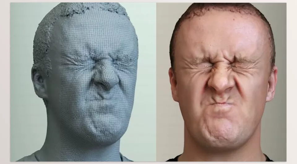
Image: Produce high-quality head scans for Halo 4 Spartan Ops.